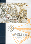
نبذة عن كتاب The Gulf in Historic Maps 1493 – 1931
After the exhibition of historic maps in Sharjah, many people asked me to publish the collection to benefit both researchers and the general public interested in the history of the Gulf.
The names of many sites and towns have been distorted in translation through time. The maps are presented chronologically and record the political and colonial changes that the Gulf region has undergone.
Vadana that appears on many of the maps should be read as Ath’an, the White Mosque that is referred to is in fact a grave on the top of the mount in Sha’am which is called the Sannam and the name Inguir is an early distortion of Umm Al Qwain. These are but three examples of the interesting and intriguing historical subtleties contained in these maps when you study them closely.
I hope that this collection will allow researchers, collectors and those interested in the history of the Gulf to compare the early maps with the highly accurate maps prepared by the cartographers of the twentieth century.


المراجعات
لا توجد مراجعات بعد.