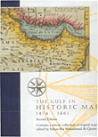
نبذة عن كتاب The Gulf in Historic Maps 1478 – 1861
The maps are presented in chronological sequence and so reflect the internal evolution in the region as well as the intervention of foreign colonial powers and the technical progress of cartography.
This book contains printed maps only. For a long time printing was a technique mainly used for the spreading of cartographic knowledge among educated people. Publishers copied maps or parts of maps from each other and presented them as their own products. It is often difficult to establish who the first to present certain new data. This book often shows ten or more versions of the same map by different publishers. Probably several more will exist and one’s collection can never be complete.This book contains printed maps only. For a long time printing was a technique mainly used for the spreading of cartographic knowledge among educated people. Printed maps contained data as umderstood by scholars at that time. The development of cartography in scholarly circles was hampered by the lack of data available and the printers themselves were often scholars at that time. The development of cartography in scholary circles was hampered by the lack of data available to scholars. Better data was often available elsewhere as can be seen in manuscript maps of Portuguese, Dutch, French or English navigators, but such data did not always arrive at the people who printed maps for the public. It was only during the 18th century that the world of navigators and the world of scholars and publishers merged into one. Copyright did not exist at the time. Publishers copied maps or parts of maps from each other and presented them as their own products. It is often difficult to establish who was the first to present certain new data. This book often shows ten or more versions of the same mape by different publishers. Probably several more will exist and one’s collection can never be complete.




المراجعات
لا توجد مراجعات بعد.